World · India Bureau
Cyclone Arnab casts shadow across half of India, satellite imagery reveals scale
Cyclone Arnab has made landfall on the Andhra Pradesh coast, with satellite imagery showing the storm system's cloud formations spanning across vast swathes of the Indian subcontinent. Authorities warn of continued heavy rainfall threats in multiple regions even after landfall.
LSN India ·
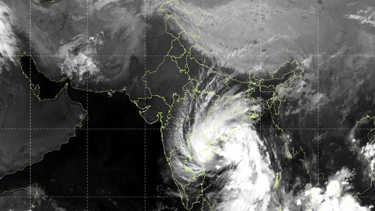
Satellite imagery from INSAT-3DS has captured the massive extent of Cyclone Arnab following its impact on the Andhra Pradesh coastline. The imagery reveals extensive cloud cover stretching across roughly half the Indian territory, underscoring the cyclone's considerable spatial reach and intensity.
The cyclone made landfall along the Andhra Pradesh coast, bringing severe weather conditions to the region. The satellite photographs document the system's organized structure and the widespread nature of associated cloud formations, which extend well beyond the immediate impact zone.
Meteorological agencies continue to monitor the storm's progression inland. Despite having crossed the coast, forecasters caution that multiple areas across the country remain vulnerable to heavy rainfall in the coming hours. The expansive cloud shield visible in satellite data suggests that precipitation impacts could affect regions considerably distant from the landfall point.
Local authorities in affected areas have intensified preparedness measures as the cyclone moves further inland. Residents in vulnerable zones have been advised to exercise caution as the system continues to pose risks through heavy downpours and associated hazards. Continued monitoring of the cyclone's trajectory remains underway to provide timely updates on weather conditions across impacted regions.