World · India Bureau
IIT Madras develops strategic ambulance positioning system for road safety
Researchers at IIT Madras have created an innovative mapping solution to optimize ambulance placement near accident-prone zones, potentially reducing emergency response times across Indian highways and urban corridors.
LSN India ·
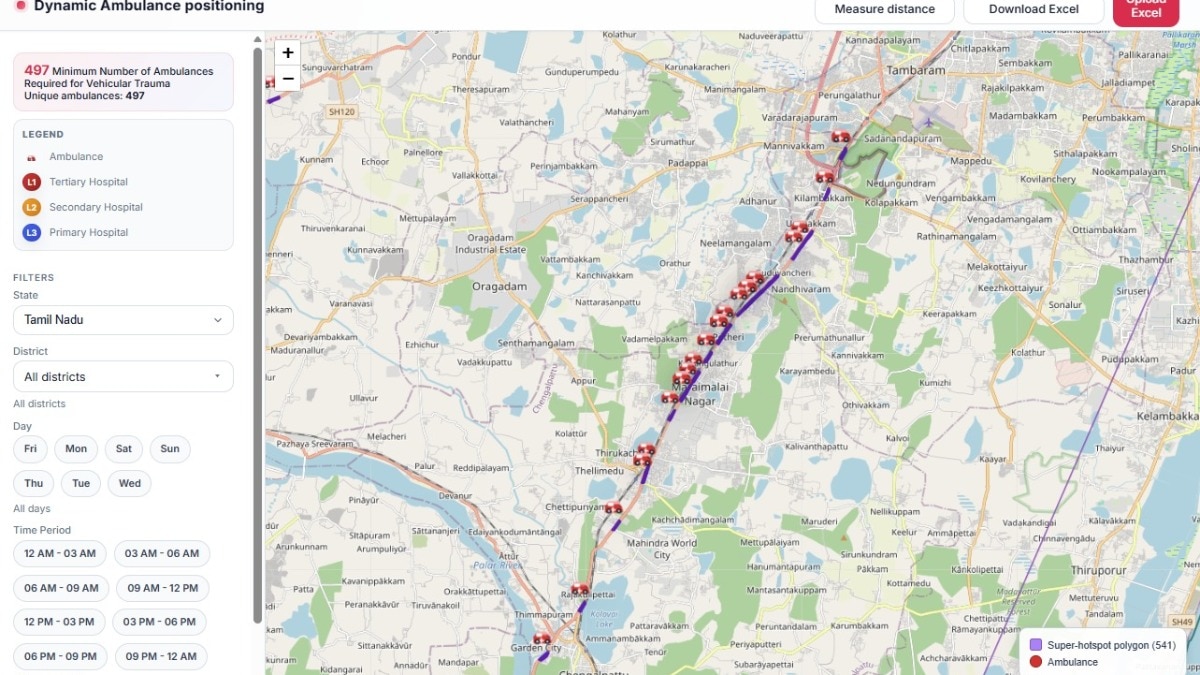
Scientists at the Indian Institute of Technology Madras have developed a data-driven approach to determine optimal ambulance parking locations in response to road accidents. The initiative addresses a critical gap in emergency medical services by using geographical analysis and accident pattern data to position ambulances more effectively.
The research team has created mapping tools that identify high-risk accident zones based on historical traffic incident records, road infrastructure characteristics, and population density. By analyzing these factors systematically, the model can recommend strategic parking positions that minimize response times when emergencies occur.
Reducing ambulance response time has emerged as a significant public health priority in India, where road accidents claim hundreds of thousands of lives annually. Faster medical intervention at crash sites can substantially improve survival rates and reduce severity of injuries, making efficient ambulance deployment crucial for emergency management systems.
The IIT Madras solution offers a practical framework that municipal authorities, highway management agencies, and emergency services can implement across different regions. By moving from ad-hoc ambulance positioning to evidence-based placement strategies, the system aims to enhance the overall efficiency of emergency medical response infrastructure in the country.