World · World News Bureau
Interactive map tool challenges perceptions of global geography
A new mapping application invites users to test their geographic knowledge by comparing country sizes across different cartographic projections. The tool visually demonstrates how map distortions affect our understanding of global proportions.
LSN World News ·
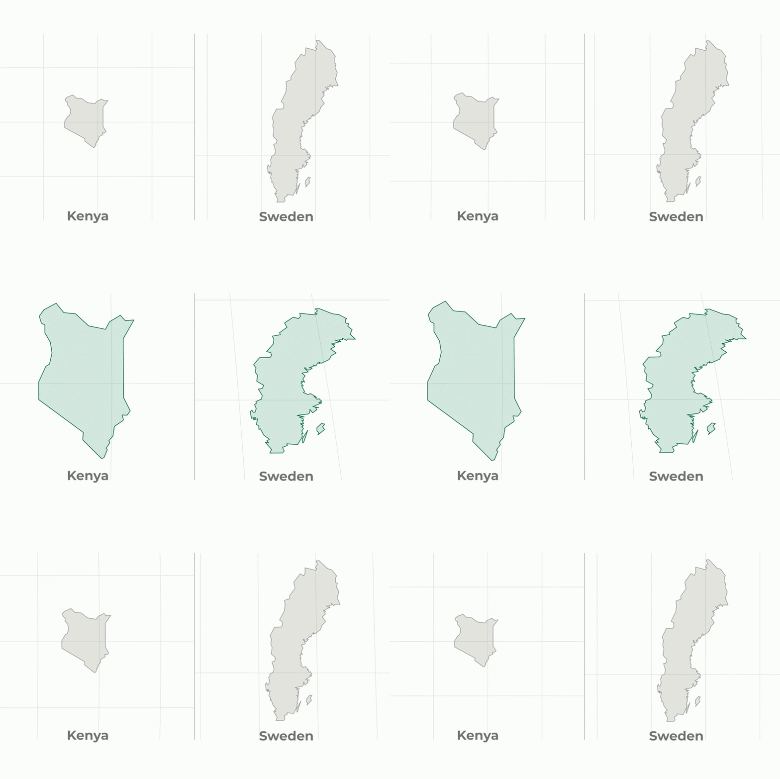
Cartographers and geography educators have long grappled with a fundamental challenge: accurately representing a three-dimensional globe on a two-dimensional surface inevitably introduces distortion. A new interactive mapping tool addresses this problem by allowing users to visually explore how different projection methods alter perceptions of country size.
The application presents users with pairs of countries and asks them to identify which is larger. After making their selection, the map morphs between the traditional Mercator projection—widely used in schools and familiar to most people—and the Equal Earth projection, which aims to represent land masses with greater proportional accuracy.
The Mercator projection, developed in the 16th century, has long dominated world maps despite significant limitations. The system dramatically exaggerates the size of landmasses near the poles while minimizing those near the equator. Africa, for instance, appears substantially smaller on Mercator maps than its actual surface area, while northern regions like Greenland and Canada appear disproportionately large.
The Equal Earth projection offers an alternative approach by maintaining accurate proportions of country sizes relative to one another. This visualization technique has gained increasing attention among cartographers and educators seeking to correct historical geographic misconceptions embedded in traditional maps.
The interactive tool serves as both an educational resource and a reminder of how representation shapes understanding. By allowing users to compare their intuitions against mathematical reality, the application highlights the importance of questioning assumptions about the world and recognizing how tools—even maps—can subtly influence our perception of global relationships.