Technology · India Bureau
ISRO satellite tracks Cyclone Arnab advancing towards Andhra Pradesh coast
Space agency imagery shows Cyclone Arnab intensifying as it moves toward the Andhra Pradesh coastline. Authorities are preparing precautionary measures ahead of the storm's expected landfall.
LSN India ·
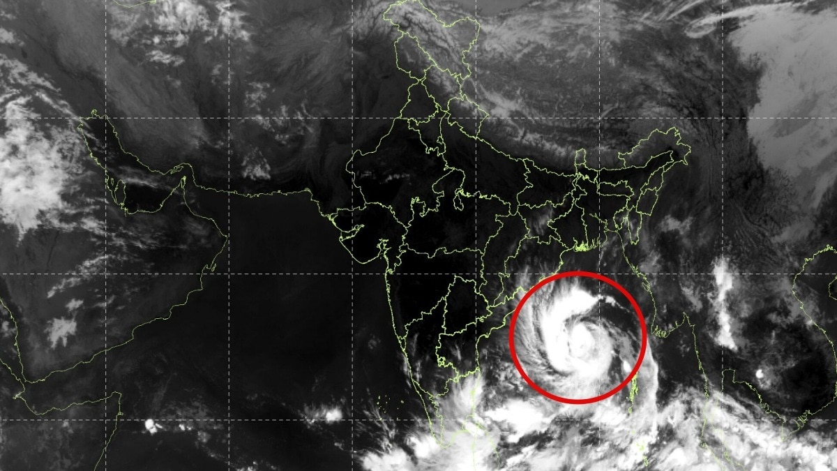
India's space agency ISRO has captured satellite imagery tracking Cyclone Arnab as it advances toward the Andhra Pradesh coast, providing real-time monitoring of the developing weather system. The satellite data offers crucial information to disaster management authorities and meteorological departments coordinating response efforts.
The cyclone, currently observed in satellite imagery, shows significant organization and is expected to make landfall along the Andhra Pradesh shoreline in the coming hours. Weather officials are closely monitoring the system's trajectory, intensity, and wind patterns to issue timely warnings to coastal residents and fishermen in the region.
State and national disaster management agencies have been placed on alert, with preparations underway for potential evacuations, relief operations, and emergency response measures. Fishing fleets operating in the Bay of Bengal have been advised to return to shore or seek safe harbor, while coastal communities are being directed to secure properties and move to designated shelters.
ISRO's satellite capabilities continue to provide critical support to India's meteorological agency and disaster response frameworks, enabling enhanced accuracy in cyclone tracking and forecasting. The real-time imagery assists authorities in coordinating relief efforts and issuing public warnings to minimize casualties and property damage.