World · India Bureau
Nepal's geography and climate create perfect storm for disasters
Nestled in the Himalayas, Nepal faces mounting natural hazards from earthquakes and landslides to flash floods and glacial lake outburst floods. A warming climate is intensifying these threats, posing severe challenges to the nation's people and infrastructure.
LSN India ·
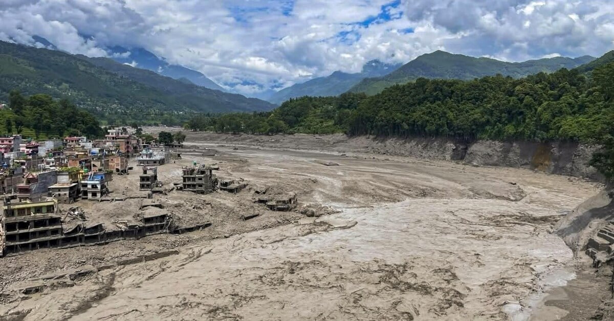
Nepal's position along the collision zone between the Indian and Eurasian tectonic plates makes it one of Asia's most seismically active regions. The country experiences frequent earthquakes that trigger cascading disasters, including devastating landslides that destabilize mountainous terrain and block critical transportation routes. These geological vulnerabilities are compounded by the nation's steep topography, where heavy monsoon rains accelerate soil erosion and trigger flash floods that sweep through valleys with little warning.
The warming climate is exacerbating these natural hazards at an accelerating pace. Rising temperatures are destabilizing glaciers and snow-covered peaks throughout the Himalayan range, creating dangerous conditions for glacial lake outburst floods—sudden releases of water that can inundate downstream communities without adequate early warning systems. Altered precipitation patterns are also intensifying monsoon downpours, increasing the frequency and severity of flooding events across the country.
Infrastructure development in Nepal has struggled to keep pace with these environmental threats. Many communities remain concentrated in vulnerable areas, particularly river valleys and steep slopes prone to landslides. Limited resources for disaster preparedness, early warning systems, and structural reinforcement mean that when natural disasters strike, the impact on lives and livelihoods is often catastrophic. The convergence of Nepal's inherent geographical vulnerabilities with the accelerating effects of climate change presents an escalating challenge to the nation's development and stability.