Technology · World News Bureau
Satellite imagery reveals extensive destruction across Gaza Strip
Satellite images document significant physical devastation in Gaza following three years of conflict, with Palestinian health authorities reporting over 74,000 deaths. The imagery underscores the scale of infrastructure damage across the territory.
LSN World News ·
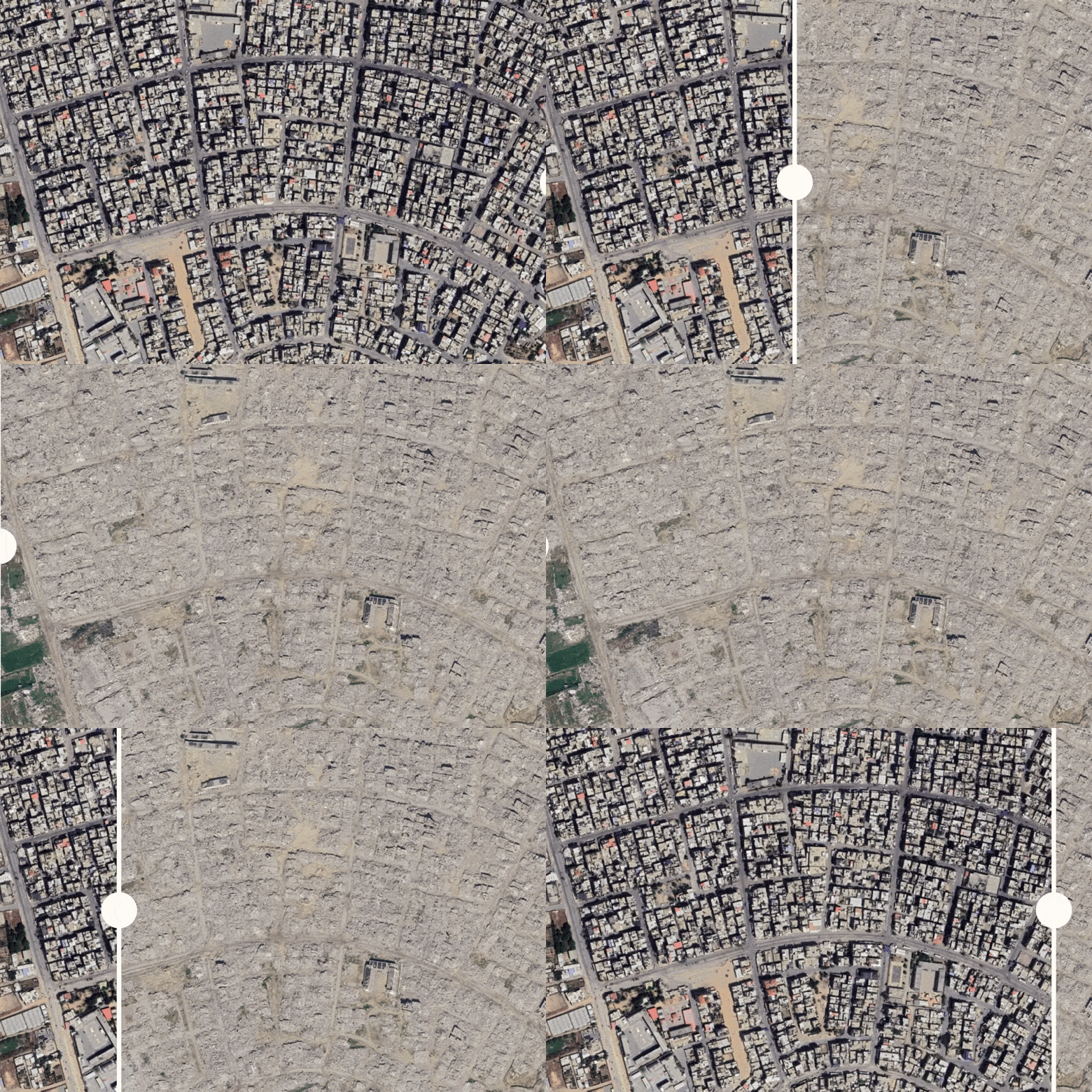
Satellite photographs of the Gaza Strip reveal extensive destruction of residential areas, commercial districts, and infrastructure throughout the Palestinian territory following sustained military operations since 2021. The images, accessible through public satellite mapping services, show widespread demolition of buildings and altered landscapes across multiple Gaza communities.
Palestinian health officials have documented more than 74,000 deaths during the three-year period, though casualty figures remain contested by various international parties. The satellite evidence provides visual confirmation of large-scale physical destruction that has affected civilian areas across the densely populated territory.
The imagery has drawn attention from international observers and humanitarian organizations monitoring the humanitarian impact of the conflict. UN agencies and aid groups have previously reported significant challenges in delivering assistance due to infrastructure damage and access restrictions.
The scale of destruction documented in satellite images raises questions about reconstruction timelines and humanitarian needs. International discussions continue regarding ceasefire proposals, aid delivery mechanisms, and potential pathways toward resolution of the long-standing Israeli-Palestinian conflict.