Technology · India Bureau
Satellite imagery tracks Cyclone Murasu's intensifying path toward Indian coast
Multiple satellite observations are monitoring Cyclone Murasu as the severe weather system advances toward India. The cyclone's development is being closely tracked by meteorological agencies across the region.
LSN India ·
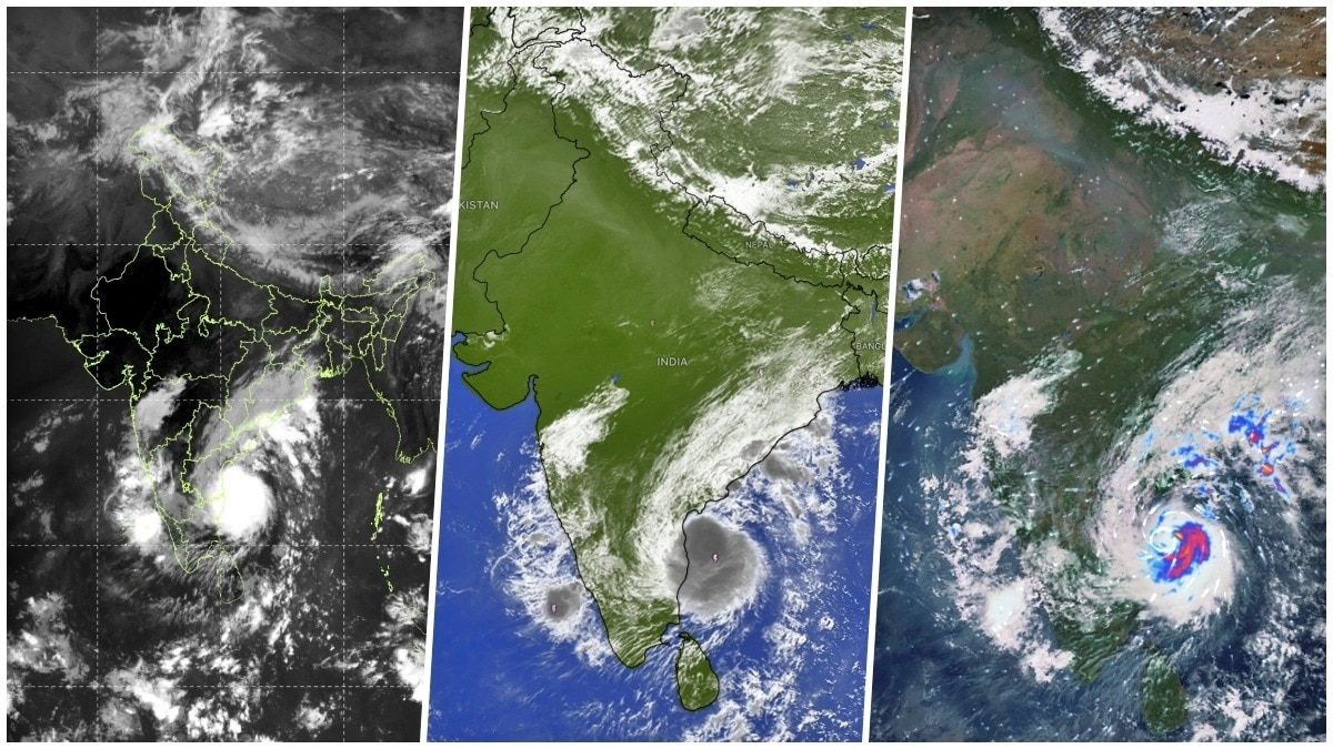
Satellite data from three separate observation platforms is providing real-time monitoring of Cyclone Murasu as it moves across the Indian Ocean toward the Indian subcontinent. The multi-satellite approach is enabling meteorologists to track the storm's structural development, intensity changes, and projected trajectory with unprecedented precision.
The satellite imagery shows the cyclone's characteristic spiral band structure intensifying as it traverses warmer ocean waters. Meteorological officials are utilizing data from multiple sources to issue timely advisories and enable coastal communities to prepare for the system's arrival.
India's weather monitoring agencies have activated emergency protocols in anticipation of the cyclone's landfall. State authorities in potentially affected regions are coordinating evacuation procedures and securing critical infrastructure. The real-time satellite observations are crucial for refining forecasts and determining which areas face the greatest risk from strong winds, heavy rainfall, and storm surge.
Cyclone season in the Indian Ocean basin typically brings several significant weather systems annually. This particular system has drawn heightened attention due to its rapid development and direct trajectory toward populated coastal areas. Continued satellite monitoring will provide critical updates as Murasu approaches, allowing officials to issue precise warnings and coordinate response operations.