Technology · India Bureau
Satellite images reveal hidden freshwater springs beneath Utah's shrinking salt lake
Newly discovered circular mounds exposed by receding water levels at the Great Salt Lake are fed by freshwater springs that contribute significantly to the reservoir's replenishment. The findings, documented through satellite imagery and field expeditions, offer new insights into the lake's water dynamics and potential dust mitigation strategies.
LSN India ·
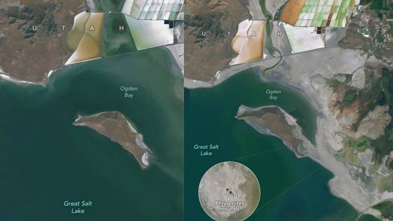
Satellite imagery has uncovered a previously undocumented network of circular mounds dotting the exposed lakebed of Utah's Great Salt Lake as water levels continue to decline. The formations, revealed through recent analysis of overhead photographs, appear predominantly in areas fed by freshwater springs, according to researchers who conducted field expeditions across the receding terrain.
The freshwater springs associated with these mounds account for approximately 12 percent of the lake's water replenishment, making them a significant but previously underappreciated component of the lake's hydrology. Scientists identified the springs by observing distinctive circular reed formations at the center of each mound, which indicate areas of active freshwater discharge into the broader saltwater system.
Beyond their hydrological importance, the mounds may also serve an environmental function. Researchers suggest that the vegetation and moisture around these freshwater sources could help suppress dust emissions from the increasingly exposed lakebed—a growing concern as the lake's surface area shrinks. The discovery adds a new layer of complexity to understanding the Great Salt Lake's water balance and ecosystem dynamics during this period of sustained decline.