World · Singapore Bureau
Tropical Cyclone Murasu: Path and impact timeline mapped
Meteorological agencies are tracking Tropical Cyclone Murasu's trajectory across the region, with forecasters providing updated projections on wind strength, affected areas and expected arrival times. Authorities in vulnerable zones are preparing contingency measures as the system approaches.
LSN Singapore ·
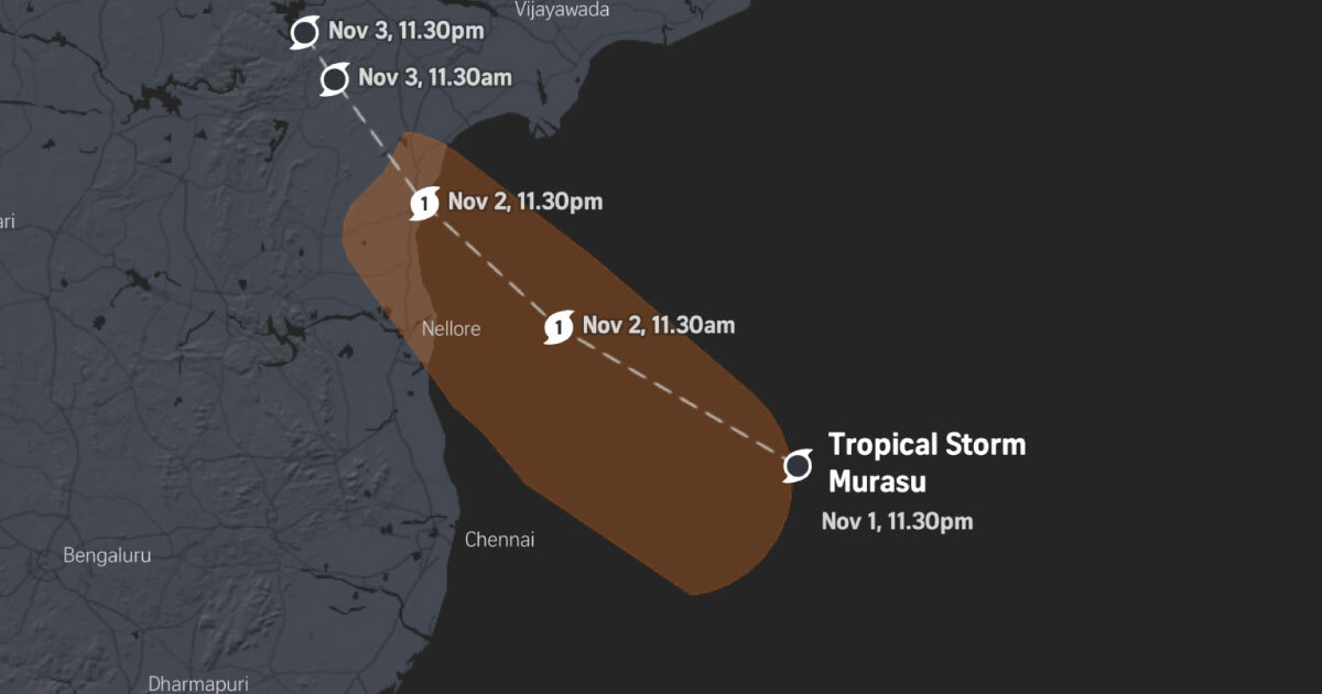
Tropical Cyclone Murasu continues its movement across the Indian Ocean and surrounding regions, with weather services issuing regular updates on its anticipated course. The cyclone's path and intensity remain subjects of close monitoring by regional meteorological centers, which are coordinating to provide the most accurate forecasting data to governments and emergency management agencies.
Wind extent projections indicate the cyclone's circulation will affect a considerable area, with tropical storm-force winds expected to extend across multiple zones. The system's current trajectory suggests it will bring significant weather impacts to communities in its path, prompting authorities to issue advisories and prepare evacuation procedures where necessary.
Arrival times vary depending on location within the forecast track. Coastal regions and island communities are expected to experience the system's most severe effects, with heavy rainfall, strong winds and rough seas anticipated as Murasu draws nearer. Emergency services have been placed on heightened alert, and residents in potentially affected areas are urged to monitor official weather updates and follow guidance from local authorities.
Regional meteorological agencies continue to refine forecasts as new data becomes available. The trajectory may shift as environmental conditions evolve, making it essential for populations in vulnerable zones to remain informed through official channels and prepared for potential impacts.