World · Sri Lanka Bureau
Trump shares map depicting Strait of Hormuz as US territory
Former US President Donald Trump has posted a map on social media that depicts the Strait of Hormuz as American territory, marking the latest in a series of contentious territorial claims.
LSN Sri Lanka ·
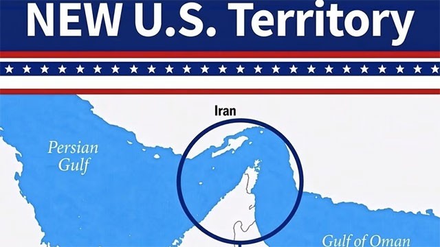
The map, shared on Trump's Truth Social platform, shows the strategic waterway between Iran and Oman coloured in the same hue as the United States, a departure from standard geographical representations. The Strait of Hormuz, through which roughly one-third of global seaborne traded oil passes annually, has long been under international maritime law governance rather than any single nation's sovereign control.
The posting appears consistent with Trump's broader approach to geopolitical matters, which has frequently emphasised American interests in regions of strategic importance. The former president has previously made statements suggesting expanded US territorial or economic claims in various regions, including references to Greenland and the Panama Canal.
The move has drawn attention from observers of Middle Eastern affairs, as the strait's neutrality and freedom of navigation remain critical to regional stability and global energy security. Iran, which shares significant coastline along the waterway, has historically been at odds with US foreign policy in the region.
Geopolitical analysts note that such representations, while unlikely to alter legal or diplomatic realities governed by international maritime conventions, reflect the rhetorical positioning that may influence US policy discussions in coming months.