World · World News Bureau
UN adopts resolution to update world map with Africa's accurate size
The United Nations has voted overwhelmingly to recognize a cartographic adjustment that depicts the African continent at its true geographical proportions. The measure, sponsored by Togo, secured support from 164 nations in the global body.
LSN World News ·
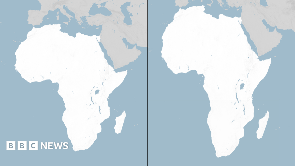
The United Nations General Assembly has passed a resolution endorsing an updated world map that accurately represents Africa's actual land area, addressing a long-standing cartographic disparity that has distorted the continent's size in conventional representations.
Togo's proposal garnered broad international backing, with 164 nations voting in favor of the measure. The resolution marks a symbolic step toward correcting the Mercator projection and similar mapping conventions that have historically diminished Africa's visual representation on global maps.
The United States stood as the sole nation to cast a vote against the resolution, though the overwhelming support from other member states demonstrated widespread recognition of the need for more accurate geographical representation.
Cartographers and educators have long noted that traditional map projections significantly underrepresent Africa's land mass, with the continent appearing roughly one-third smaller than its actual size. The new cartographic standard aims to provide students and policymakers with more proportionate visual representations of global geography.
The adoption reflects growing international attention to how visual representations shape global perceptions and understanding of different regions and their relative importance on the world stage.