Culture & Entertainment · Malaysia Bureau
UN endorses new world map to correct geographical distortions
The United Nations has adopted a new map projection that more accurately represents the true sizes of continents, addressing long-standing distortions in the widely-used Mercator map that has dominated geography education and media for centuries.
LSN Malaysia ·
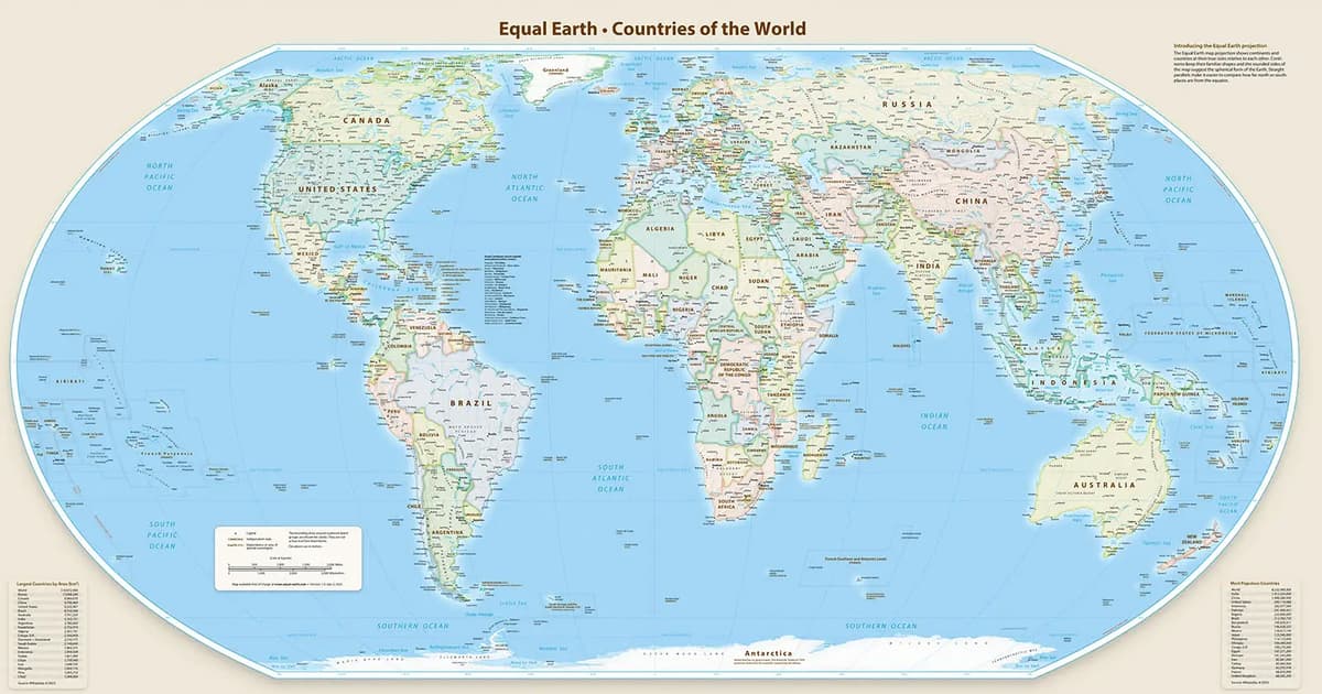
The United Nations has called on its member states to transition away from the traditional Mercator projection in favour of a new cartographic representation that corrects significant size distortions among continents and countries.
The Mercator projection, developed in the 16th century, has become the standard map used globally in classrooms, news media and government offices. However, the projection systematically exaggerates the size of landmasses at higher latitudes while diminishing those near the equator. This results in Africa, which covers approximately 11.7 per cent of Earth's land surface, appearing considerably smaller than it actually is, while countries like Greenland and Russia appear disproportionately large.
The new map projection recommended by the UN provides a more mathematically accurate representation of continental proportions. The adoption reflects growing recognition among cartographers and international bodies that conventional map projections carry implications for how nations and regions perceive their place in the world and their relative importance on the global stage.
Member states have been encouraged to adopt the new projection for official documents, educational materials and public communications. The shift aims to promote greater geographical awareness and fairness in how different regions are visually represented in international discourse.